《地圖繪制軟件》(Global Mapper v10.02)[壓縮包] 簡介: 中文名 : 地圖繪制軟件 英文名 : Global Mapper v10.02 資源格式 : 壓縮包 發行時間 : 2008年 制作發行 : rockware 地區 : 美國 語言 : 英文 簡介 : 語言:英語 網址:http://www.rockware.com/product/overview.php?id=91 類別:地圖繪制軟件 Global Mapper 是
"《地圖繪制軟件》(Global Mapper v10.02)[壓縮包]"介紹
中文名: 地圖繪制軟件
英文名: Global Mapper v10.02
資源格式: 壓縮包
發行時間: 2008年
制作發行: rockware
地區: 美國
語言: 英文
簡介:
語言:英語
網址:http://www.rockware.com/product/overview.php?id=91
類別:地圖繪制軟件
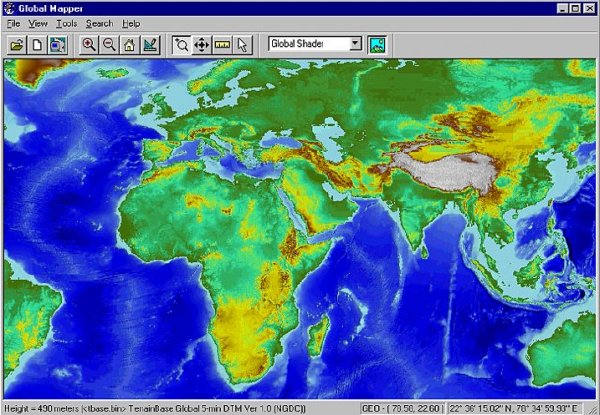
Global Mapper 是一款地圖繪制軟件,不僅能夠將數據顯示為光柵地圖、高程地圖、矢量地圖,還可以對地圖作編輯、轉換、打印、記錄GPS及利用數據的GIS(地理信息系統)功能.6.xx版增加了直接訪問USGS(美國地質勘探局)衛星照片TerraServer數據庫和Global Mapper內部的地形圖及以真實的3D方式查看高程地圖的功能.
浏覽、合成、輸入、輸出大部分流行的掃描點陣圖、等高線、矢量數據集的軟件,它可以編輯、轉換、打印各類地圖圖形文件,可以利用全球情報系統(GIS) 信息資源。它可以轉換數據集的投影方式以符合你的項目的座標系統,並可以同時對數據集的范圍進行裁剪。它還提供距離和面積計算,光柵混合、對比度調節、海拔高度查詢、視線計算,以及一些高級功能,如圖像校正、通過地表數據進行輪廓生成、通過地表數據觀察分水嶺、對3Dpoint數據轉換為三角多邊形和網格化等。通過內建的腳本語言或眾多的批處理轉換選項能夠高效地完成重復性任務。
NFO:
代碼
英文名: Global Mapper v10.02
資源格式: 壓縮包
發行時間: 2008年
制作發行: rockware
地區: 美國
語言: 英文
簡介:
語言:英語
網址:http://www.rockware.com/product/overview.php?id=91
類別:地圖繪制軟件
Global Mapper 是一款地圖繪制軟件,不僅能夠將數據顯示為光柵地圖、高程地圖、矢量地圖,還可以對地圖作編輯、轉換、打印、記錄GPS及利用數據的GIS(地理信息系統)功能.6.xx版增加了直接訪問USGS(美國地質勘探局)衛星照片TerraServer數據庫和Global Mapper內部的地形圖及以真實的3D方式查看高程地圖的功能.
浏覽、合成、輸入、輸出大部分流行的掃描點陣圖、等高線、矢量數據集的軟件,它可以編輯、轉換、打印各類地圖圖形文件,可以利用全球情報系統(GIS) 信息資源。它可以轉換數據集的投影方式以符合你的項目的座標系統,並可以同時對數據集的范圍進行裁剪。它還提供距離和面積計算,光柵混合、對比度調節、海拔高度查詢、視線計算,以及一些高級功能,如圖像校正、通過地表數據進行輪廓生成、通過地表數據觀察分水嶺、對3Dpoint數據轉換為三角多邊形和網格化等。通過內建的腳本語言或眾多的批處理轉換選項能夠高效地完成重復性任務。
Global Mapper
Global Mapper is more than just a viewer capable of displaying the most popular raster, elevation, and vector datasets. It converts, edits, prints, tracks GPS, and allows you to utilize GIS functionality on your datasets in one low cost and easy to use software package. Global Mapper also includes the ability to directly access the entire TerraServer database of USGS satellite imagery and topographic maps free of charge and to view elevation data in true 3D with any loaded raster imagery and vector data draped on top of it!
Your data files can be loaded as layers, for example a Digital Elevation Model (DEM) can be loaded with a scanned topographical map to create a 3D view of the map. A digital aerial image can be draped on the surface together with vector contour mapping to create a stunning and informative graphic. The results can be printed, or the workspace can be exported to a high resolution raster image for use in a presentation or report.
NFO:
代碼
²
²²
²
²
²
²
²
²²
²²
²
² ²
°°°° ²² °°°°° ² °°°°° °°°°°
²²
² ²
²
sQz²
²
²
Global Mapper v10.02 (c) Global Mapper Software
² ִִִִִִִִִִִִִִִִִִִִִִִִִִִִִִִִִִִִִִִִִִִִִִִִִִִִִִִִִִִִִִִִִִִִִִִִִִִ ²
± Disks: 6 x 5,00mb Date : January 29, 2009 ±
° OS : Windows °
² Release Description:
~~~~~~~~~~~~~~~~~~~
Global Mapper is more than just a viewer capable of displaying the most
popular raster, elevation and vector datasets. It converts, edits,
prints, tracks GPS and allows you to utilize GIS functionality on your
datasets in one low-cost and easy-to-use software package.
Global Mapper also includes the ability to directly access multiple
online sources of imagery, topographic maps, and gridded terrain data.
This includes access to worldwide high resolution color imagery from
DigitalGlobe (watermarked access for free) and access to the entire
TerraServer-USA database of USGS satellite imagery and topographic maps
free-of-charge. Global Mapper also has the ability to easily access WMS
data sources, including built-in access to elevation data and color
imagery for the entire world, and to view elevation data in true 3D with
any loaded raster imagery and vector data draped on top of it!
°
Installation:
² """""""""""""""
± Just unpack&install. Move patch.exe to installdir and use it.
°
Greetz:
² """""""""""""""
°
Contact Us:
² """""""""""""""
±
°
相關資源:


- [行業軟件]《有限元分析工具》(MSC MD NASTRAN)V2010.1.3[壓縮包]
- [操作系統]win7 30in1
- [軟件綜合]《Symantec norton 2006 all in one》(Symantec norton 2006 all i
- [網絡軟件]《德比賽馬》(derby stallion )簡體中文漢化測試版[光盤鏡像][PSP] 免費下載
- [多媒體類]《DVD多媒體視頻解決方案》(TMPGEnc Authoring Works v4.0.2.14 Retail)[壓縮包]
- [多媒體類]《專業樂譜制作軟件 》(Sibelius 6)V6.0.0.54/更新最新完整版[壓縮包]
- [系統工具]《Acronis系統備份還原工具》(Acronis True Image Home 2012)更新Plus Pack/含注冊碼[壓縮包]
- [操作系統]《Micosoft Windows XP Professional X64 正式版》(Micosoft Windows XP Professional X64 Edition Final)[ISO],操作系統、資源下載
- [應用軟件]《日歷/行程管理軟件》(mozilla sunbird+Borg Calendar for veket)1.0 中文版(附增簡單漂亮的萬年歷(含農歷))[安裝包]
- [行業軟件]《Altium Protel DXP SP3 電子電路設計軟件》(Altium Protel DXP SP3)Design Explorer Version 7.3.64,行業軟件、資源下載
- [學習課件]《正統道藏》+《藏外道書》全集
- [電視游戲]《職業棒球之魂2010》(Pro Yakyuu Spirits 2010)日版[光盤鏡像][PS2]
- [軟件綜合]Lunascape簡體中文官方正式版
- [英語學習資料]《李妲莉《日本語初級綜合課程》【Flash+PPT】》[壓縮包]
- [多媒體類]《Cloanto C64模擬器》(Cloanto C64 Forever)v2012.3.0 Plus Edition[壓縮包]
- [教育科技]《代數學》(Algebra)[DJVU]
- [教育科技]《計算流體力學》(Computational Fluid Dynamics)英文版
- [其他圖書]《藥學類高職高專系列教材:天然藥物學》掃描版[PDF]
- [光盤游戲]《艾倫希亞戰記》
- [小說圖書]《侯衛東官場筆記 第9部》精校文字版[PDF]
- 《中望CAD 2008i》(ZwCAD 2008i Professional Edition)中文版(簡、繁體) / 英文版
- 《達索SolidWorks 2012 X32 X64 多語言版本(含簡中)》(DS SolidWoks 2012 SP0.0)2012[壓縮包]
- 《三維機械設計系統》(SolidWorks)v2011 SP4.0 + Delcam &CAMWorks (WIN32/WIN64)[壓縮包]
- 《交互式3維數據可視化系統》(Fledermaus Pro v6.3.0o)
- 《歐特克MEP CAD》(Autodesk AutoCAD MEP)2011 Win32/64[光盤鏡像]
- 《測井及井眼繪圖軟件》(Golden Software Strate)v3.4.807[壓縮包]
- 《CAD/CAM/CAE集成軟件》(PTC PRO ENGINEER WILDFIRE V4 M070)X86[光盤鏡像],行業軟件、資源下載
- 《茶繪君》(alpha)beta[壓縮包]
- 《建模程序》(CSI Concepts Unlimited V3.629 )英文,行業軟件、資源下載
- 《Ashampoo 3D CAD 專業版》(Ashampoo 3D CAD Professional v1.0.9.9)[光盤鏡像]
- 《AUTODESK DWF COMPOSER》V2[Bin]
- 《家居裝潢設計》(FloorPlan 3D Design Suite 11.0 )英文
免責聲明:本網站內容收集於互聯網,本站不承擔任何由於內容的合法性及健康性所引起的爭議和法律責任。如果侵犯了你的權益,請通知我們,我們會及時刪除相關內容,謝謝合作! 聯系信箱:[email protected]
Copyright © 電驢下載基地 All Rights Reserved